Hefei maneuvers to become city of satellites

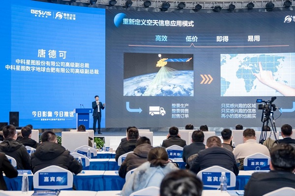
The launch ceremony of GEOVIS Earth DataDaily takes place in the Hefei high-tech zone on Jan 5. [Photo/gxq.hefei.gov.cn]
GEOVIS Earth, a subsidiary of China Geovis Co Ltd, released a new product named GEOVIS Earth DataDaily that will provide users with instant, rich and convenient remote sensing data information services in the Hefei high-tech zone – located in Hefei city, capital of East China's Anhui province on Jan 5.
The GEOVIS Earth DataDaily has gathered over 200 global remote sensing satellites in orbit to create a simple and transparent superstore-like transaction experience, with super computing power and platform data processing capabilities.
Meanwhile, it can actively deliver information within 24 hours of satellite transit and quickly deliver results within 24 hours of production orders.
China Geovis Co is a high-tech company engaging in aerospace data systems and services. The company says the new product is expected to redefine the applications mode of air and space information and improve the current upstream and downstream imbalance of supply and demand in the industry.

Tang Deke, senior vice president of China Geovis Co gives a presentation at the ceremony. [Photo/gxq.hefei.gov.cn]
Overall, the city of Hefei has brought together nearly 60 businesses and units associated with the air and space information industry.
They cover upstream satellite manufacturing, midstream satellite operations and ground equipment and downstream data application aspects of the industry supply chain.
Moving forwards, plans are for Hefei to accelerate the commercialization of space information.


