Explore Linxia Geopark in the spring

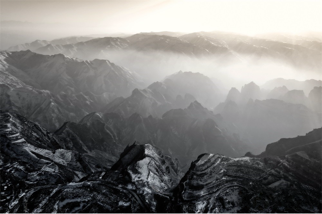
The enchanting beauty of Linxia Geopark in Linxia Hui autonomous prefecture, Gansu province. [Photo provided to gogansu.com]
In the early spring, distant mountains are cloaked in snow, offering a picturesque backdrop as we explore the diverse landscapes of the Linxia Geopark.
Located within the Linxia Hui autonomous prefecture, the geopark spans two distinct natural regions—the arid Loess Plateau and the cold and humid Qinghai-Tibet Plateau. Covering an area of 2,120 square kilometers, it encompasses six counties and cities, including Yongjing, Hezheng, Dongxiang, Linxia, Guanghe, and Linxia. Integrating geology, ecology, and culture, this geopark stands as a comprehensive geological wonder.
The Bingling Stone Forest, a product of early Neogene (approximately 120-144 million years ago) Cretaceous red sandstone deposition, showcases the unique Danxia landform. It features an array of distinct Danxia stone columns, peaks, cliffs, gorges, and caves, creating a breathtaking natural sculpture museum with towering peaks, competing ravines, and picturesque formations.
The Danxia landform is a distinctive geological type formed by the erosion, transportation, abrasion, and weathering of red sandstone gravel under the influence of water along vertical joints. These formations take on various shapes, including upright, fortress-like, and pagoda-like structures.
In areas with steeply inclined rock strata, erosion gives rise to undulating, dragon-like monoclinal ridges; when multiple monoclinal ridges are adjacent, they form a monoclinal peak cluster. During the transition from winter to spring, in the late afternoon, when backlit or sidelit, a natural ink painting emerges, where form and spirit blend harmoniously, creating a seamless fusion of nature and art.
-
As AI encounters Dunhuang's art, the ancient caisson ceiling bridges centuries to the present.
View all stories

 Gansu thrives from green development
  >
>