Home>About
Qianxinan Bouyei and Miao Autonomous Prefecture
(chinadaily.com.cn) Updated: 2016-09-12
Hydrology
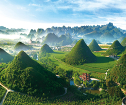
The prefecture sits in a low-latitude, high-altitude mountainous area that is higher in the west and north and lower in the east and south. Most of it is 1-2 kilometers above sea level and has an undulating, complex topography that can be classed as eroded canyons among hills, karst plateaus, karst mountains and karst river valleys. The prefecture has 102 rivers with a drainage area of more than 20 sq km each, and the three largest rivers are the Nanpan, Beipan, and Hongshui. From early May, when the water levels rise, the flow and sand content soar until the end of October when the muddy rivers gradually become clear again and the water level drops. Water flow during the flood season, May - September, accounts for 80 to 90 percent of the year's total. The wet season runs June - August.
Mineral Resources
The prefecture has an abundance of minerals -- as many as 41 kinds -- with explored reserves of coal, gold, antimony, fluorite and marble. It ranks 3rd in Guizhou province in coal reserves at about 19 billion tons. It has an exceptionally large ore deposit, 4 large ones and 4 small ones, and dozens of mineral spots, which account for more than 90 percent of the province, hence the China Gold Association's designation -- "China's Golden Prefecture".