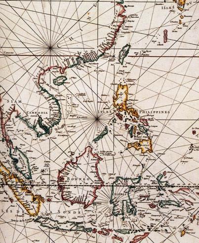
In reprinting his first edition of Le Neptune Oriental in 1753, Jean Baptiste Nicolas Denis d'Apres de Mannevillette (1707-1780) the famous French cartographer implemented recalibration on the basis of observation findings of the French Royal Academy of Sciences a chart of the Netherlands and added a new map Cart Réduite de L'Ocean Oriental Depuis le Cap de Bonne Espérance, Jusqu'au Japon, that is, Map of the Navigation Route from Cape of Good Hope to the East Ocean of Japan. In the French map, three atolls to the western coast of Luzon Island of the Philippine Islands, were named B. Bolinao, B. Marsingola and B. Mariveles from north to south, but Huangyan Dao was not marked. In other words, before the Scarborough struck a reef and sank, neither the Philippines nor Europeans to the east had learnt about the existence of Huangyan Dao.

Cart Réduite de L'Ocean Oriental Depuis le Cap de Bonne Espérance Jusqu'au Japon


 Overview
 Resources & Environment


 QQ 好友
QQ 好友 微信好友
微信好友 易信好友
易信好友 QQ空间
QQ空间 朋友圈
朋友圈 百度空间
百度空间