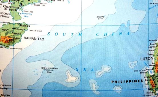
In 1974, the fourth edition of Goode's World Atlas was published by Rand McNally & Company in the US. In the 192nd map entitled "China and Japan" the Chinese mainland and southeast coast was depicted, and the northern section of the South China Sea was shown. Dongsha Qundao were marked as "PRATAS" with the annotation "China" in brackets, while Xisha Qundao were marked first in Webster phonetic alphabet based on its Chinese name, with the annotation "Paracel Islands (China)."

Close-up View of Map of East China


 Overview
 Resources & Environment


 QQ 好友
QQ 好友 微信好友
微信好友 易信好友
易信好友 QQ空间
QQ空间 朋友圈
朋友圈 百度空间
百度空间