Prepared in 1952 by the Department of Geodesy Mapping and Cartography of the Soviet Ministerial Council, the map was distributed by Omsk Cartographic Plant. In the map, the islands of Dongsha Qundao, Xisha Qundao, Nansha Qundao and Huangyan Dao were marked, with Russian names transliterated from Chinese, and the annotation "КИТ.", which stood for China in Russian.
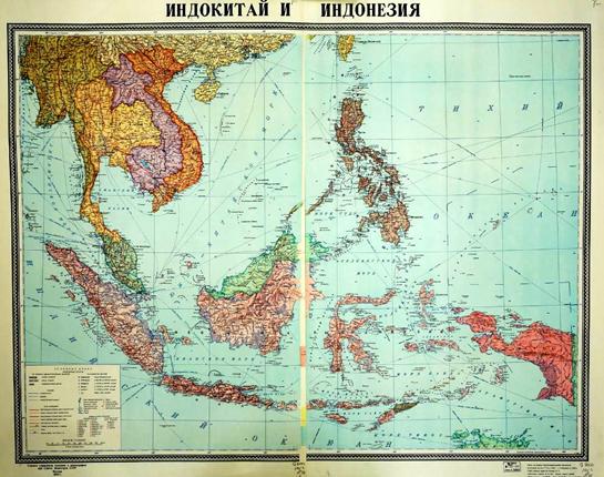
Map of Indochina Peninsula and Indonesia
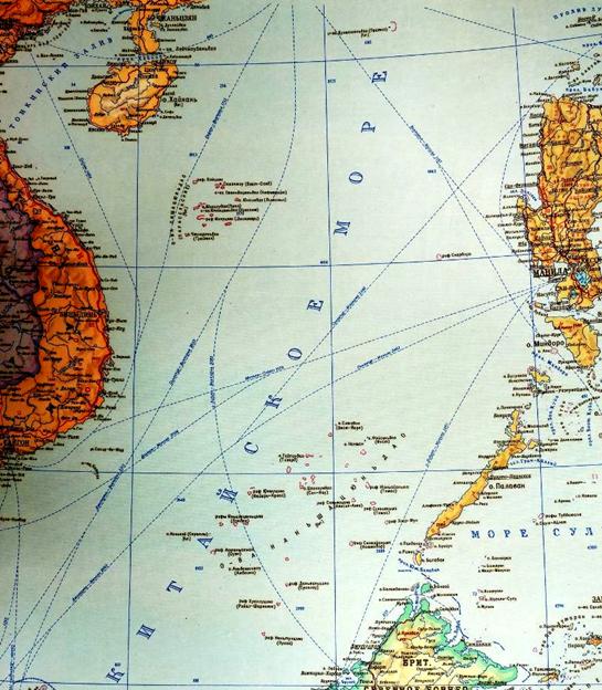
Close-up View of Map of Indochina Peninsula and Indonesia


 Overview
 Resources & Environment

 QQ 好友
QQ 好友 微信好友
微信好友 易信好友
易信好友 QQ空间
QQ空间 朋友圈
朋友圈 百度空间
百度空间