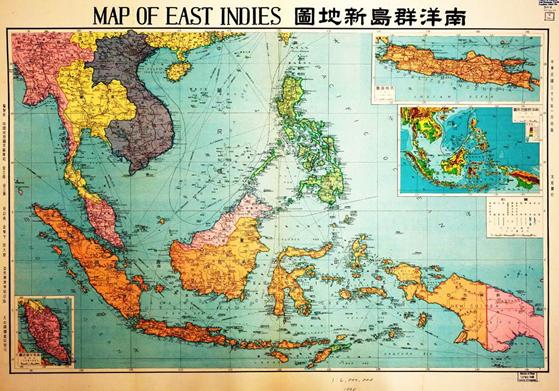
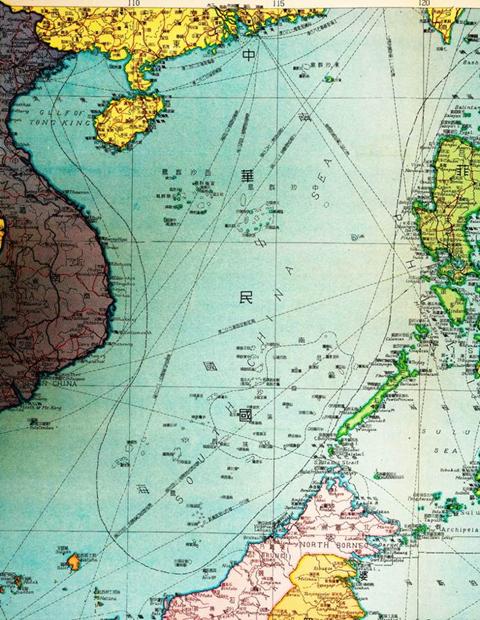
Prepared by Jin Lihuang and Jin Lihui of Chinese Historical Map Press in 1948, and published by Yaguang Geographic Press and distributed by Greater China Bookstore, the map adopted the new pattern and new names for Nanyang Qundao in Southeast Asia, following the new names released by the Ministry of Interior for Nanhai Zhudao. In the map, Dongsha Qundao, Xisha Qundao, Zhongsha Qundao, Nansha Qundao, Nanshi (Huangyan Dao) and Zengmu Ansha (James Shoal) in the southernmost point of the South China Sea were all enclosed in waters bordered with dots and solid lines. The entire waters were superimposed with "Republic of China", indicating the Chinese sovereignty over Nanhai Zhudao.

Map of East Indies

Close-up View of Map of East Indies


 Overview
 Resources & Environment


 QQ 好友
QQ 好友 微信好友
微信好友 易信好友
易信好友 QQ空间
QQ空间 朋友圈
朋友圈 百度空间
百度空间